
Cycling in Cessnock
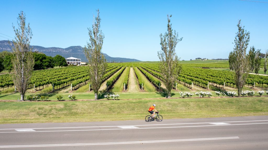
The Lower Hunter is a fantastic place to ride. We have open roads (many with good shoulders, some without) and they connect a wide variety of destinations. Wineries, mine ruins, mountain-top lookouts…we have it all.
MTB Riding
Cessnock and Kurri are MTB towns and there’s a stack of options for trail riding and singletrack. Check out the MTB options here.
Pump
Cessnock has a pump track! Find out more about this new community facility here.
Road Riding
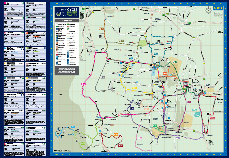
Cycle Hunter Valley Map
We’re foundation members of the Cycle Hunter Valley network, you can download this pdf of the map and explore the valley at your own pace. There’s routes for Road, MTB and Gravel, along with service points on most routes that can help you if you’re in trouble.
Gravel Riding
From Wollombi heading West into Yengo National Park there’s weeks worth of Gravel to explore. These shorter options are closer to the wine country:
Werakata National Park Map
In 2023 we worked with Cessnock Council to create this map of the main section of Werakata National Park.
From the parking at Astill’s Picnic Area (K10 on the map) you can explore the excellent gravel trails and link to the townships of Lovedale and Abermain. This is high quality gravel, you’ll love it!

Werakata Outer Loop
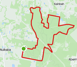
This loop follows the outer-most trails of Werakata National Park and is easily accessed from Lomas Lane in Nulkaba.
Perfect for MTB and Gravel bikes, park at the Wildlife Park and roll in for 25kms of serene bush and well-groomed gravel roads.
Start your day with this ride then visit the Zoo afterwards and you’ll be ready to hit the wineries in the afternoon.
25kms with 100m of climb, 1.5hrs to complete.
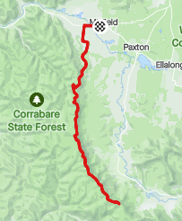
Paxton-Congewai-Paxton
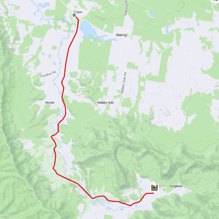
Is there a more peaceful and scenic gravel ride in the lower Hunter? We don’t think so.
Starting at the village of Paxton, you’ll ride the lovely Congewai Road past serene acreage and grazing cattle.
If you’re on the road early you’ll see more kangaroos than cars. Stop for a drink and a photo at the causeway then roll back to the Paxton Hotel for a great pub lunch.
32kms, 150m of climbing, 2 hours to complete.
Millfield-Flat Rock-Millfield
Want to work hard for a great view? This ride is for you, it’s a favourite of our Saturday Explorer group for its combination of scenery and exercise.
Start and finish at The Central, Millfield, turn left onto Hayes Rd and don’t stop until you’re at Flat Rock Lookout. It’s a good solid climb up there!
You’ll have a view north over Congewai valley and some great photos for the socials.
38kms, 1100m of climbing, 2.5hrs on an ebike.
Here’s some other local routes from our GoPro:
It’s 13km from Cessnock to Millfield, stop at The Central for a rest then come back to Cessnock or the Vineyards via Bimbadeen Lookout at Mt View.